Search This Blog

The Church that Moved – or did it?


The church that stood on the corner of High Street and Silver Street was known as St Peter at Arches, the “Arches” came from its position close to The Stonebow.
There is evidence that by the 11th Century two St Peters stood in the churchyard: St Peter at Arches and St Peter at Pleas (so-called because of its proximity to the Moot Stone which was located near Ruddock's shop).
In 1719 an application for a brief for rebuilding the church of St Peter at Arches was made to the City Council.  A loan of 1000 shillings ( the equivalent of about £4,500 today) was taken up at interest by the city for the rebuilding of the church, repayable over 10 years.  The church was built by William Smith and consecrated in 1724 as the Corporation church.
Some notes from the Corporation records:
In 1722 Lord Thanet donated 40s. towards the rebuilding.
In 1723 a further 600s. was voted by the Corporation for the completion of the church
In 1738 “two persons” gave 8s. for a clock and chimes at St Peter's
19th century drawing of St Peter at Arches
18th-century drawing of St Peter at Arches Church
In 1786 4s. granted in addition to 6s. already granted to be distributed by the minister and churchwardens of St. Peter-at-Arches among such persons as shall sing or perform upon any musical instrument in that church during divine service on the Lord’s day.
St Peter at Arches was closed in 1929 and demolished in 1933.
St Giles church was designed by W G Watkins and built in 1936 on the new St Giles estate northeast of Lincoln in the same style as St Peter at Arches.  Much of the decorative stonework was used but the structural stone was replaced by brick.  It can be seen from the pictures that an additional bay was added to the building of St Giles Church.
St Giles Church shortly after its completion in 1936
St Giles Church shortly after completion in 1936

The 1794 organ, built by J Lincoln of London and restored by “Father” Henry Willis of Henry Willis & Sons, was also moved to St Giles and installed by 
Cousans, Sons and Co.  The 8 bells of 1728 were installed together with the peal board of 1756, the oldest surviving in the county
St Giles Church is quite unique in that it is one of the few churches with its altar at the west end of the church, the probable reason for this is that it was built opposite St Giles Junior School with its main door facing the school.

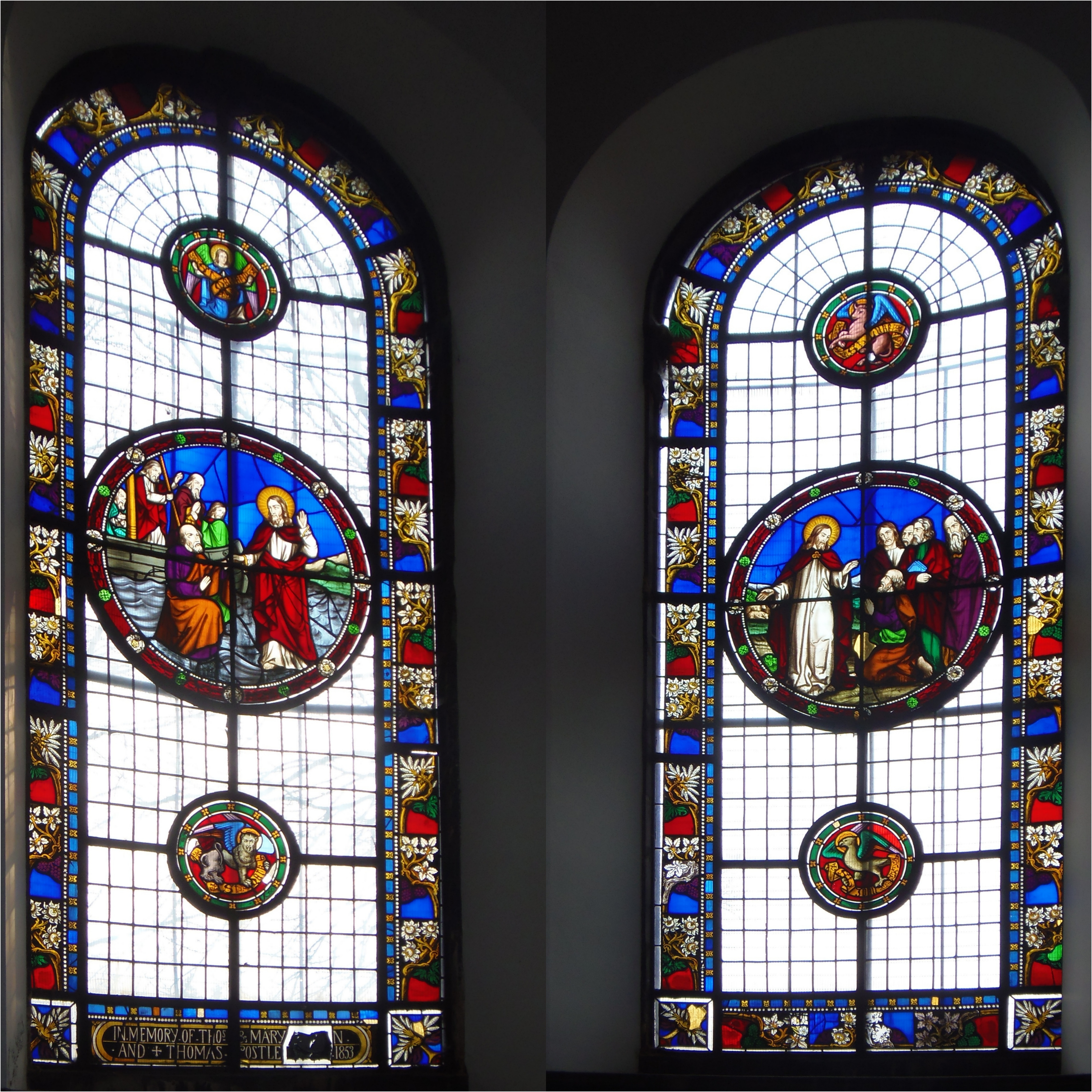
The Dawber window removed from St Peter at Arches


Lincoln's High Bridge, Unique In This Country


High Bridge on Lincoln’s High Street is the oldest surviving bridge with buildings on it in this country. It marks the spot where the Roman Ermine Street crossed the Witham by way of a ford; a bridge was built c. 2nd century.

The river was much wider than today, and High Bridge was thought to be made of five arches; today, only one arch remains.

There were many bridges like High Bridge in the Middle Ages—London Bridge, for example—but all the others have long since disappeared. The only other bridges with buildings on them in England are Frome Bridge, dating from 1667, and Bath’s Pulteney Bridge of 1773.


At the time of the Reformation, there were as many as 52 religious buildings in Lincoln. One of these was a chapel dedicated to St Thomas the Martyr, which stood on the eastern side of the bridge over its vaulted arch. The chapel had originally been funded by the Lincoln Corporation around 1200. Following the Reformation, the Corporation converted the building into a house; it was later leased as a hall to the Company of Tanners and Butchers, and finally used as a warehouse until its demolition in 1763.

An obelisk was then erected, which also served as a water conduit that brought water from near the end of Monks Road. The original pipes for this were laid by the friars of Greyfriars in the early 16th century. The obelisk was removed in 1939 due to concerns about the strength of the arch supporting it. A reconstruction of the obelisk can now be seen at St Mark's Shopping Centre.


The Glory Hole
Showing Ribbing

The river route under the bridge was once named "The Murder Hole*"; bodies could be dropped in the water here without being seen and, with luck, would float downriver to Boston and onto the Wash.

The maximum height of 9 feet and width of 22 feet, together with an awkward angle under the bridge, sets a limit on the size of vessels that can use the Witham from Brayford Pool to Boston and vice versa. It now has the much happier name "The Glory Hole." This may come from the difficulty of getting large vessels through; there would be some "glory" when a boatman made it through!

Until the 1790s the river was not navigable all year; in summer the bed of the river was often dry. There are tales of horses and coaches driven across the river in summer just west of High Bridge. Joseph Banks (1743–1820), the botanist and naturalist, had commissioned the building of the Horncastle Canal; he could see that revenues on his canal would be severely restricted by the problems at High Bridge.

The Corporation was reluctant to improve the navigation under the bridge because they earned porterage from the trans-shipping of cargoes. This reluctance forced Joseph Banks to look at alternative routes. William Jessop (1745–1814), the noted canal builder (locally he built the Grantham and Sleaford canals), was commissioned to investigate a likely route.

Jessop put forward a scheme to route barges from Brayford Pool southwards on the upper Witham to Sincil Drain, in effect bypassing Lincoln. The Corporation realized this would be devastating for the economy of the city and, in 1795, the bed of the river beneath High Bridge was lowered at the expense of the proprietors of the Horncastle Canal. To celebrate the event, boards were laid on the dry riverbed and a dance took place under the bridge.


1902/3 Reconstruction

The buildings on High Bridge were renovated and put back to their original half-timbered design in 1902/03 under the direction of architect William Watkins. Jettied forward from the first floor are carvings of King Edward VII and Queen Alexandra.

High Bridge remains an architectural gem; Stokes coffee shop is an excellent place to enjoy a coffee. R W Stokes Co. has ground and blended coffee here for over 100 years.

On either side of the shops on High Bridge, there are steep, narrow steps leading toward Lincoln’s Brayford Pool, where barges and ships loaded and unloaded their cargoes. From the footpaths on the west side, you can get an excellent view of the rear of the shops.


*Murder Hole to Glory Hole

In the Middle Ages, the High Bridge acted like a giant funnel. Because the Norman stone archway (built around 1160) was so low and narrow, the river's current naturally trapped floating debris against the masonry.

Unfortunately, this debris frequently included human remains. If someone was murdered or drowned upstream in the Brayford Pool under the cover of night, the current would carry the body straight down to the bridge, where it would become wedged or wash up at the entrance of the dark, claustrophobic tunnel.

The structure of the bridge itself made it incredibly easy to commit a crime unnoticed. Because the bridge has uniquely supported timber-framed houses and shops since the medieval period, anyone looking to get rid of a body could simply drop it directly into the churning waters of the Witham beneath the overhanging buildings.

In the pitch black of the unlit medieval streets, a body dropped into the "hole" would disappear immediately into the dark tunnel, hidden from view. Local lore even suggested that if a criminal had enough luck, the current would carry the evidence all the way downriver toward Boston and out into the Wash, leaving no trace behind in Lincoln.

View under the High Bridge at Lincoln
Frederick Nash (1782-1856)


From Murder to Glory: The shift to the name "The Glory Hole" happened centuries later as the river became a bustling commercial highway. Navigating a large, awkwardly shaped barge through the tight, 22-foot-wide gap required incredible skill; boatmen who successfully squeezed through without damaging their vessel earned the "glory" of a flawless transit.

Today, the darker history has faded into local folklore, and instead of looking for medieval footprints of the macabre, visitors are much more likely to pull up a chair at Stokes High Bridge Cafe right above the old archway for a cup of coffee.


Further Reading:


The Lost Houses of Lincolnshire - Haverholme Priory

Haverholme is 4 1/2 miles north east of Sleaford. Referred to in Domesday Book as Holm, later becoming Hufreholme and then Hafreholm.

Alexander, Bishop of Lincoln offered a marshy island site near Sleaford to Abbot Gervase of Fountains Abbey in 1137. Buildings were erected by 1139 and a band of Cistercian monks were sent from Fountains to take possession. The monks were unhappy with the site and Bishop Alexander offered them land in the north of the county, where Louth Park Abbey was built.

Alexander then offered Haverholme to Gilbert of Sempringham. Gilbert founded the only English religious order and was unique in accepting men and women into the same houses albeit in separate accommodation.

The number of nuns at Sempringham was increasing and the buildings at Haverholme were ready for occupation. The priory at Haverholme was dedicated to St Mary. St. Gilbert sent nuns, lay sisters and lay brothers to Haverholme, but at first they suffered severely from poverty, Simon Tuchet granted the priory lands in nearby Ashby in 1140. Later benefactors included Henry II, Roger Mowbray and Roger de Lacey.

In 1164 Thomas Becket, Archbishop of Canterbury, "from his angry sovereign in fear of his life, he took refuge in the hermitage belonging to Haverholme Priory, on the edge of the fen, under the guidance of a monk who knew the country."

Gilbert had limited the numbers in the house to 100 nuns and lay sisters, and 50 canons and lay brothers. At the Dissolution the members of the Priory had dwindled down to a small number.

The deed of surrender is dated September 5th, 1539, and by it William Hall, the Prior, and six canons gave up the Priory and all the estates belonging to the Priory, and in return, together with the prioress and seven nuns, received pensions for life varying from £4 to £2 per annum.

The Priory was granted to Edward Lord Clinton, who, by the King's licence, granted half the manor to Robert Carre in 1544, and the other half to William Thorold. The property passed through several owners until it was bought by Sir Samuel Gordon, 1st Baronet in 1763. The property passed, on his death, to Sir Jenison William Gordon, 2nd Baronet. In 1788 Sir Jenison improved and enlarged the building.
The Priory, south and east aspects c. 1800

Sir Jenison died in 1831 and bequeathed the Priory to George William Finch-Hatton, 10th Earl of Winchilsea, 5th Earl of Nottingham. Henry Edward Kendall was commissioned to redesign the Priory, the work being completed in 1835. A resemblance to Haverholme Priory can be seen in Carre's Hospital at Sleaford, another of Kendall's designs.

Henry Stormont Finch-Hatton, 13th Earl, was the last owner of the Priory. After World War I, in common with many landed families, the 13th Earl decided to put the Haverholme Priory Estate up for auction.


South aspect c 1925


East end of south aspect and Orangery


The auctioneers were the well-known local firm of Earl and Lawrence and took place on Monday, 9th August 1926 at the Corn Exchange, Sleaford. The Priory sold for £5,400 to a Mr Caley of Manchester who, after the departure of the Finch-Hatton's by 11th October, would demolish the building. A sad end to a fine country house.

There is a story that circulates in the local Sleaford area that the Priory was bought by an American heiress who intended to rebuild it in the United States. The story goes on, she was killed in a train crash, the stone was stored at Liverpool docks and was eventually used to repair dock walls. Read the true story here

Henry S Finch-Hatton's second son was Denys Finch-Hatton, Denys was a white game hunter in East Africa and was killed in a flying accident in 1931. He was the subject of the film "Out of Africa", starring Robert Redford and Meryl Streep.


The Ruins on the Hill: Uncovering the Lost Village of Calceby

When I was too young to drive, my parents and I would journey from Lincoln to Mablethorpe on summer weekends in Dad’s Ford Model Y. Our route took us through Belchford and Alford, passing a particular hillock on the Bluestone Heath Road where ruins still sit upon the crest. Despite consulting locals and scouring OS maps, we were never been able to identify exactly what they were.

Remains of St Andrew's Church, Calceby


 Fast forward more years than I care to remember, and I now know those ruins are the remains of St Andrew’s Church, Calceby.

Calceby’s roots predate the Norman Conquest; it was once one of 84 Lincolnshire villages belonging to Earl Harold—known briefly in 1066 as King Harold II. Following the Conquest, King William granted the village to Earl Hugh of Chester. The name itself is Old Scandinavian, translating to ‘Kalfr’s village.’

At the time of the Domesday Book, Calceby was a thriving settlement of 151 villagers, featuring extensive ploughlands, 1,000 acres of meadow, and 80 acres of woodland. However, after reaching its peak in the 11th century, the village entered a long, slow decline. By 1377, only 60 villagers were recorded for the poll tax; by 1563, that number had dropped to 18 families. By 1961, the population had dwindled to just 32.

Aerial Map of Calceby, showing outlines
of various features (Bing)


While many factors can lead to a village’s abandonment, the "Great Pestilence" of the 14th century was a significant catalyst. The reality of this era was unearthed in 1952, when a plague pit was discovered during the widening of Bluestone Heath Road nearby. Beyond disease, a changing climate brought years of poor harvests, forcing many to abandon their homes in search of food.

However, the primary cause for the loss of Calceby—and roughly 100 other Wold villages—was the shift from arable farming to more profitable sheep rearing. As landowners replaced crops with livestock, the demand for labor plummeted. This forced the population toward larger centers like Alford, Horncastle, and Spilsby. By the 17th century, 20 farms had been abandoned, and the process was finalized when Sir Drayner Massingberd (1615–1689) began enclosing the open fields in November 1672.

The village's spiritual heart soon followed its people. The last baptism at St Andrew’s took place in 1724, the same year its final vicar, William Pennington, was instituted. By the time Calceby was united with South Ormsby and Kelsby in 1750, the church had fallen into serious disrepair. In 1756, much of the structure was demolished and sold to the South Ormsby estate.

Today, a fragment of Calceby lives on elsewhere: when St Leonard’s Church in South Ormsby was restored by James Fowler of Louth in 1871–72, a 12th-century round-arched doorway was installed in the west wall—a piece of history said to be salvaged from the ruins of St Andrew’s.

The Doorway from St Andrew's, Calceby
© Richard Croft
 https://creativecommons.org/licenses/by-sa/2.0/


Click link to view side by side image of OS map and LiDAR 


If you enjoyed reading this blog why not join our Historic Lincolnshire Facebook Group


The Lost Houses of Lincolnshire - Sudbrook Holme

Sudbrook Holm c. 1800


Sudbrooke Holm was probably one of the largest and most impressive country houses near Lincoln.  The house stood near a lake in 200 acres of parkland 5 miles north-east of Lincoln.  Built by Richard Ellison, (1721-1792) in 1780, his son Richard Ellison. (1754-1827) later enlarged the house.

Richard Ellison bought a 999-year lease on the Fossdyke Navigation in 1741 from Lincoln Corporation.  The canal had been neglected for many years, Richard improved the canal and soon barges were able to carry goods to and from Lincoln.  

In 1775 Ellison, Senior formed a partnership with Abel Smith and John Brown to open Lincoln’s first bank, Smith, Ellison and Brown, each partner held equal shares;  Abel Smith was a grandson of Thomas Smith who opened the country’s first provincial bank in Nottingham in 1658.

Richard Ellison the younger was one of the members of parliament for Lincoln from 1796 to 1812.

Sudbrook Park early 20th century
Large amounts of money were spent in furnishing the interior of the house with many art treasures. It was famous for its library of bookcases made to the designs of the acclaimed eighteenth-century architect, Robert Adam. The house had twenty-eight main bedrooms; the principal rooms were decorated in the Adam style with many beautiful ceilings. Plant supplying acetylene gas was used to light and heat the house and an excellent supply of water was drawn from artesian wells.  

The gardens were famous and highly regarded.

Coningsby Charles Sibthorp, J.P. purchased the house and park in 1877, he lived there for over 30 years.

Entrance to the former Sudbrook Park

Two new lodges and wrought-iron gates were erected in 1910, the gates were made by Frederick Coldron and Son, ecclesiastical and artistic iron workers and blacksmiths of Brant Broughton. The gates had bells fitted to attract the attention of the lodge keepers. The gates fitted today are recent replacements as the original gates were sold at auction for £95.


By 1911 Coningsby Sibthorp was living at the Dower House at Canwick, but there were still 12 servants living-in at Sudbrook Holme, and 11 servants living-in at Canwick. Coningsby’s wife, Mary, died in 1902 and was possibly the reason he “downsized”.  

Until the mid-nineteenth century most men and women in Lincolnshire were employed in agriculture or worked in service, but the coming of industrialisation meant that owners of large houses were finding it more difficult to employ servants at economical wages.  This situation was exacerbated by the First World War when many women gained new skills working for the war effort.  
Sudbrooke Holme in 1919 and the 1920 Sale Notice

The house and grounds were auctioned at the Lincoln Corn Exchange on Thursday 2nd October 1919.   Included in the sale were several farms 'with most superior houses', two gentlemen's smaller residences, small holdings and accommodation land, consisting of 1938.736 acres. The estate sold for  £50,000, but the house was withdrawn at £15,000.  

Ernest Terah Hooley, the millionaire financier and fraudster purchased the house sometime before 1926; it was announced on 10th January 1926 that Lincoln Corporation had an option to purchase from Hooley. The option lapsed on 5th February 1926.

The house was demolished in 1928, the interiors were carefully removed and fetched much more that the £15,000 that was reached at auction. Today the park and lake are overgrown, modern homes mix with the older estate houses.

Coningsby Charles Sibthorp died in 1932, the last male member of the ancient family that dated back to Saxon times.

It has been suggested that Sibthorp sold the estate due to some loss of fortune, but he left £93,500 in his will which today would be worth around £15,000,000.

Coningsby Charles Sibthorp's great grandmother was Susannah, daughter of Richard Ellison who comissioned the building of Sudbrook Holme